Well, this supposedly was at one point a sheep trail, for moving the critters into and out of the high country. It's basically a straight line from start to finish, with few concessions to human hikers. This trail made the Davis Peak hike a couple weeks ago look like a cakewalk and at the time, that had been this summer's standard for crazy-difficult hikes.
The Scatter Creek trailhead starts at 3200' about 1/8 mile off the main Tucquala Lake road, north of Lake Cle Elum, across from the Scatter Creek campground. The signed turnoff is just a bit past where the creek crosses the road (often dry in late summer). There's enough parking for maybe 4-5 cars. Heading north into the cool pine forest, the trail picks up Scatter Creek in about a quarter mile. It's here that that the trail start going up very smartly and it doesn't relent until a small meadow is reached at about 5800'.
The trail follows the creek for another one-half mile, bordering the top of an ever-heightening gorge, and then turns northward toward the spine of the ridge which it more or less follows for the next two miles. At about 5000' views open up to the west. On this day, at least, the sun now finds the trail and things can become very warm. After mid-summer there will be no water except for a very small stream near the pass, where I would recommend using a purifier, as it is a popular watering hole for various animals passing through.
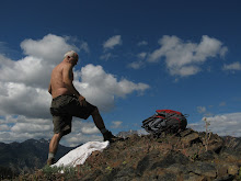
At close to 6000' find the aforementioned stream and swamp and a couple flat spots for camping. Work your away across a wet meadow and pick up the faint trail on the other side. Go through a short section of forest at which point the trail enters a talus slope where you need to pay close attention not to lose your way. After climbing very steeply for a quarter mile, you enter another (drier) meadow, across which is Van Epps Pass, which appears as an opening between the trees. The pass itself is a classic example of a low point in a ridge separating two sides. The views on the other side are spectacular, across to Jack Ridge and beyond that to the Stuart Mountains. The trail now continues as the Meadow Creek Junction, down to the isolated Jack River Valley, far below. Around the pass are numerous campsites and unlimited rock scrambling opportunities.
The hike itself is only a little over 3 miles each way, but includes nearly 3000' of elevation gain. At 1000' gained per mile. the grade averages out to nearly twenty percent. Time up was 2.5 hours; time down was 1.5 hours. I rate this trail very highly as reaching the pass affords outstanding views and there is a great sense of accomplishment in completing such a strenuous hike. Make no mistake though--this is not for the faint of heart. You must be in decent physical shape or this trail will play you out after the first half mile.